

Grotto Mountain
An Ideal “Plan B”
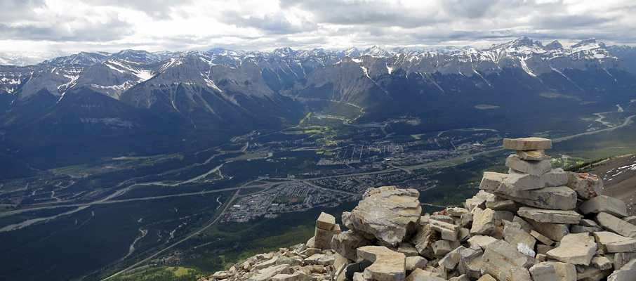
Above: A lovely view over Lac des Arcs and the Town of Exshaw from the summit of Grotto Mountain.
June 29, 2012 / minute read( words)
Grotto Mountain wasn't particularly on my list of “must-dos” for this summer, but bad weather stretching from Saskatchewan River Crossing through Banff had sent me running eastward to Canmore. With the day already drifting into the afternoon, I needed something that was local, reasonably quick, and wouldn't require any additional research on my part. Having recently topped Mt. Lawrence Grassi, I figured I'd try something from the other side of the valley. After enduring a few hours of steep forest hiking along the well-maintained ACC trail, what I found made me quite glad that I had chosen Grotto Mountain.
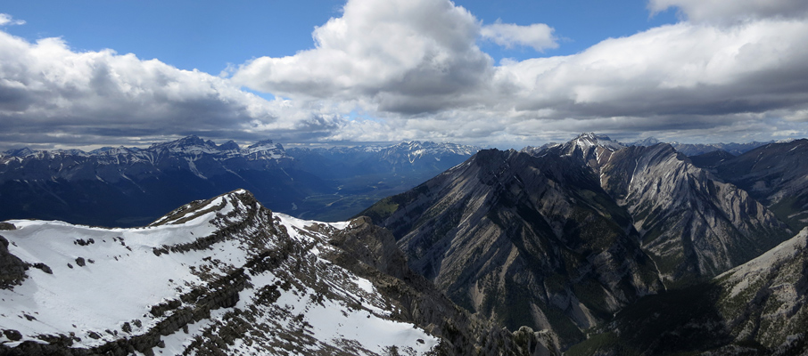
Once you gain the Grotto's extensive summit ridge, you're treated with views that are not only excellent in every direction, but also quite different as well. There's a mountain town with many lakes and waterways in one direction, the impressive Mt. Charles Stewart (and its outliers) to the northwest, an interesting arid region to the northeast, and then a large lake to the southeast. Furthermore, you get to take that all in while traversing a ridgewalk that's challenging enough to be interesting and fun, while safe enough to allay any nervousness.
Routefinding
Options abound when it comes to tackling Grotto Mountain as there are no fewer than three starting points: Cougar Creek to the west, the ACC trail from the ACC Hostel, and a third from Grotto Cave in the east. Many people will combine the Grotto Cave access with one of the other two to traverse the entire length of Grotto Mountain. However, this would require a second car (or a hidden bike) at the destination trailhead to avoid a long, and boring, 8km+ walk along a road back to your starting point. Because I had only my car and limited time, I chose to use the ACC trail for both my ascent and descent.
Although the route was recorded with a GPS unit, this data should only be used as a SECONDARY navigation tool.
To reach the ACC trail, take the Bow Valley Trail (Hwy 1A) northeast from the Trans-Canada Highway (Hwy 1) for 2km and then turn left onto Indian Flats Road (you should see a sign for the ACC hostel). This road zig-zags slightly before reaching a series of parking lots intended for hostel guests. You'll want to park on the west side of this road near an area with a large log pile; it's here on the right (east) side, between the logs and the first hostel parking lot, that you'll find the trailhead.

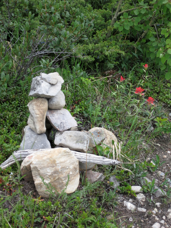
This trail has excellent signage in the beginning as you walk along a series of open slopes that provide good views of Grotto Mountain. Once you've followed the signs to the main ascent trail, the forest closes in, and it becomes difficult to gauge where you are relative to the top of the treeline and how you're progressing up the mountain. The only navigation tip needed for the forest section is to take the climber's right at a large cairn which you'll encounter about halfway up. The climber's right path is the ascent route for Grotto, whereas the climber's left route will lead you towards the Cougar Creek trailhead area.
It takes at least 2 hours and a kilometre (3,281 ft.) of elevation gain before you'll step foot on the open, rocky slopes which lead to the summit ridge. Note that the trail emerges here not far from a very steep cliff to the climber's left. If you feel like “poking your nose over” and taking a look at what lies between Grotto and Mt. Lady MacDonald, make sure that your feet are well planted to avoid an express return via Cougar Creek. There is a reasonable path that cuts diagonally across this slope, but expect to deal with some sections of loose scree as you go.
Share this report on:
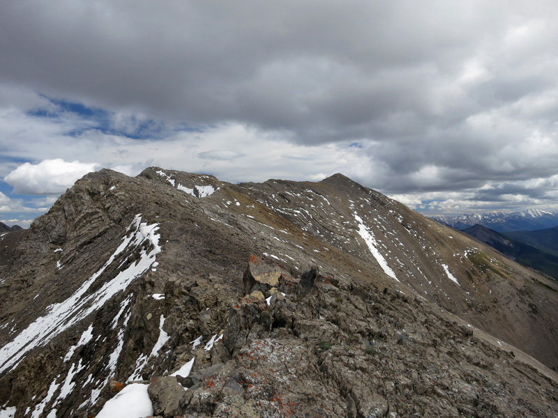
Once you've gained the summit ridge, you'll be faced with a 2-kilometre traverse to the proper summit that follows a series of high points. For me, this the best part of the trip. Aside from the greatly expanded views in each direction, the ridge offers a nearly continuous stretch of easy scrambling. If you can handle some minor exposure, the best (and by far quickest) route for this area is to take the highest line possible, which consistently offers the best rock to travel on. If you don't like the look of a particular stretch, you can easily drop down to the climber's right at any point and also to the climber's left after the third high point (where the ridge broadens). Before you know it, you'll be at the summit and enjoying your first clear views of the Lac des Arcs area, including mountains such as Mt. McGillivray and Skogan Peak. After you've had your fill, return to the trailhead by retracing your route.
Further Reading
The ascent of Grotto Mountain is also described in Alan Kane's Scrambles in the Canadian Rockies.


")


 and Mt. Lougheed (right)")


