

 September-23-2011
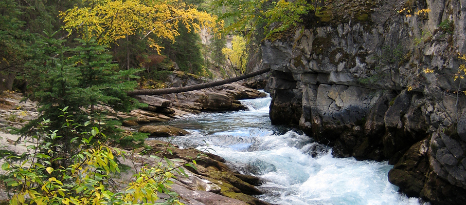
 Located just outside of the Town of Jasper where the Maligne Valley spills into the Athabasca River, Maligne Canyon offers a short and very picturesque hike during spring, summer, and fall months. In winter, when the canyon's waters freeze over, the area becomes a favourite for ice climbers who come to ascend the many waterfalls.
Unfortunately, due to its proximity to Jasper, and the easy accessibility afforded by its manicured trails, the canyon also happens to be quite a tourist trap for most of the year. However, as these pictures should attest, there are some trade-offs that are worth paying.
Trip Information
With two starting points, and three parallel trails, Maligne Canyon offers a variety of route possibilities. However, regardless of where you start, or how you plan to loop the trails, you'll want to travel in a counter-clockwise direction; this will ensure that you'll climb the portion next to the canyon, enjoying the best possible views.
Both trailhead parking areas are located off of Maligne Road, which can be reached from the Yellowhead Highway (16) at a turnoff minutes north of the Town of Jasper. The first parking area (the “5th Bridge”, or A on the map) is located 3km from the highway on the left, and the second (B) is a further 3km down the road (left again), and is also home to a small tourist centre.
Taking the 7h trail from the upper parking lot will lead you along a forested ridge with occasional lookout points that offer impressive views of Pyramid Mountain, the Town of Jasper, and the mountains beyond (including the Whistlers Peak, Indian Ridge and Marmot Mountain). The trail continues through the forest for several hundred metres before curving steeply down towards the main trail and the “5th Bridge” (the alternative starting point).
From that junction, simply follow the Maligne River path (7) back to the top of the canyon. The path is easy to follow as many sections are paved and elevation changes have been tamed with steps and handrails. It is possible to detour from the trail at many places to get a closer, or different, look at the canyon; particularly in its broader, lower sections (although be careful to not trample the vegetation). However, it's best not to bypass any rails or fencing as they're intended to discourage significant falls.
Considerations
A pair of hiking poles is highly recommended for the very steep, and continuously so, descent on the 7h trail described above. Furthermore, that part of the trail should be avoided completely in wet conditions. Alternative routes include simply retracing your steps along the canyon, or using the middle trail (7f, which is the most consistently graded of the three) to form a loop.
Due to the northwesterly orientation of the canyon, and the nearby Colin Range Mountains looming 1200m overhead to the immediate east, photographers should aim to visit Maligne Canyon in the afternoon to enjoy the best lighting conditions. Note that many of the waterfalls can be difficult to see from the trail, let alone photograph, and that you may have to be patient at times when people wander into your “shot”.
There are a number of guiding companies and recreation clubs that organize winter trips to Maligne Canyon for ice climbing or a casual hike up the frozen Maligne River. If heading out on your own, bringing crampons and a helmet is highly recommended (if not essential), as is ensuring that the river is completely frozen and exercising care near potential ice fall hazards.
Those seeking a quieter, more natural canyon hiking experience should consider visiting Beauty Creek/Stanley Falls near the Columbia Icefields.


