


 September-29-2012
 Mt. Rae is the tallest mountain in Highwood Pass and one of the most accessible 10,000 footers in the Canadian Rockies. A moderately difficult scramble beginning from the popular Ptarmigan Cirque trail, an ascent of Mt. Rae will afford one with decent views of the Highwood Pass area, the front ranges to the east, and glimpses of the Kananaskis lakes area to the west.
This was my second attempt on Mt. Rae as an earlier visit to the mountain with Steven saw me too injured to venture far from the vehicle (blisters from our Skoki marathon epic). Although he reached the summit, a large forest fire to the west (resulting in a bingo hall-like summit experience) ensured that we both had a less than stellar day.
In our first trip together Eric (of Summitsearch.org) and I would get snowed on during our arrival at the summit, but would fight off the cold long enough to get some dramatic photos as the clouds began to clear.
Trip Information
An ascent of Mt. Rae begins from the Pocaterra Day Use parking area near the base of Pocaterra Ridge on Highway 40, roughly 17 km south of the seasonal closure gates and the turn-off to Peter Lougheed Provincial Park. This parking lot tends to fill up very quickly during larch season, so if you're headed here in September, come early. You'll find the trailhead to Ptarmigan Cirque after crossing the road and heading half a kilometre north along it.
As I'm writing about this ascent a year after the fact, I would suggest consulting the Kane route description or another resource for additional specifics regarding the ascent route.
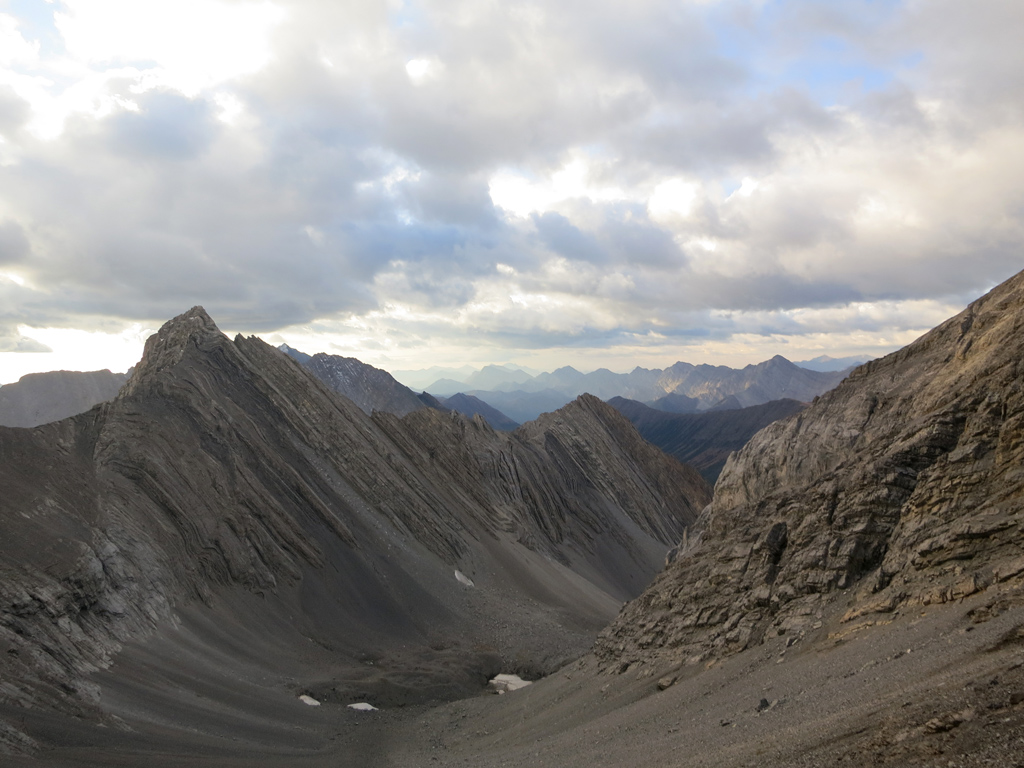
I recall following a well-signed trail through the forest and then across open meadows (be sure to take in the views behind you) to a broad rock gully with a small raised plateau and a large cairn. This will be the point where the majority of people will stop in this popular area.
From there you'll continue along a scree trail on the climber's left which curves around the rockface to the left and then up to the a rocky ramp which leads out of the broad gully and onto the ridge. Be careful at this ramp! There is a ton of very loose material directly above it and anyone above you could easily send rocks tumbling your way. We were the first up the mountain that morning, but were forced to dodge multiple projectiles on the return by a careless party headed in the other direction. Needless to say bring your helmet for this one!
A scree trail resumes once you're on the ridge and you should use it to bypass the first highpoint by contouring around it on the climber's left. As you advance further up the ridge towards the summit you will eventually get to choose between scrambling up and along the ridge crest, or taking an easier route (technically, not effort-wise) through the scree on the left side for a while first. If you head for the ridge top be weary of the significant exposure to the climber's right as the can be measured in the hundreds of metres.
While the bypass will allow you to avoid most of the exposure, the two routes do eventually link up for the last push towards the summit. You'll need to cross a very exposed, knife-like section of the ridge before reaching the last steps to the summit, and this is the crux of the trip. After you've enjoyed your time at the summit, retrace your steps back to the parking area.
Considerations
The Highwood Pass area is only accessible (by vehicles at least) between June 15 and December 15 every year due to seasonal closures. Given the high altitude of the mountain and particularly its crux, your best bet would be August and September for a snow-free ascent.
Further Reading
The ascent route for Mt. Rae is also described in Alan Kane's Scrambles in the Canadian Rockies (pg.180).


")


")


 is singnificantly lower (Storm and Mist far left).")


 and Mist (far) Mountains")


")


