

 June-08-2013
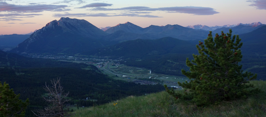
 While Mt. Saskatoon doesn't look like much of a mountain from the Crowsnest Pass town of Coleman, it's an easy hike that possesses the ability to surprise. My expectations for this mountain were very low when Steven, Ben and I began following the trail up before sunrise, but the combination of great light, tons of wildflowers, interesting trees, and a great vantage point for Crowsnest Mountain made for a very worthwhile photography outing.
Trip Information
Reaching the trailhead for Mt. Saskatoon is fairly straight forward; just follow Hwy 40 north from where it intersects with Hwy 3 at the east end of Coleman. The road will meander a bit through a residential area before the paved road gives way to a gravel road heading away from town. From where the gravel road begins, it's roughly 2.5 km to the trailhead, which will be on your left (west) just after passing a Texas gate. A roadside pull-out can be used for parking a little further ahead on the right (east) side of the road.
Finding a route up Mt. Saskatoon isn’t particularly challenging, simply follow the trail along a fence line for a few hundred metres, passing underneath a large hydro line, until you reach a large clearing where you can see the rest of the route. That small hill ahead of you on the horizon is Saskatoon’s “summit ridge”, and while the trail eventually fades out as you come nearer, reaching the top is simply a matter of picking a gap between the few trees which line the hillside and making your way up its mildly steep, grassy slopes.
If you take a reasonably straight line up the hill from where the trail led you in, the true summit will be not too far away to the climber’s right (north). However, before you head there, you’ll want to cross the ridge on a westerly heading towards a rocky outcrop which provides an excellent vantage point for taking photos of the region. Once you’ve taken in all the sights and checked out some of the interesting trees which dot the summit area, simply find an easy line downhill towards the hydro lines, and the trail back to the road.
")


")


