Giant's Gate Logo

Hiking

Activity

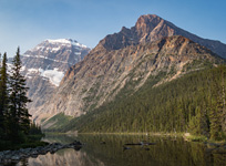
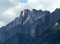
Hiking itself shouldn't require much of a description, as it's essentially the act of walking in a non-urban environment. However, I will point out that trips listed here with the hiking/scrambling combination are likely hikes for the majority of their duration, but will include more difficult sections that could require as much as hands-on climbing (read through the descriptions for specific details). I also highly recommend the use of trekking poles while hiking. It's not just about stability; trekking poles are great for getting extra propulsion on flats and inclines, and for distributing impacts on descents. Learning how to use them properly will allow you to travel further, faster.

Reports featuring this activity

Mount Rainier

– Max. Elev. 4,392 m / 14,409ft. –
Pacific Northwest / The United States

Mount Saskatoon

– Max. Elev. 1,811 m / 5,942ft. –
Crowsnest Pass

Mount Sorrow

– Max. Elev. 3,010 m / 9,875ft. –
Tonquin Region / Jasper National Park

Mount Wilcox

– Max. Elev. 2,884 m / 9,462ft. –
Columbia Icefields / Jasper National Park

Mount Willingdon

– Max. Elev. 3,373 m / 11,066ft. –
Icefields Parkway (South) / Banff National Park

Nigel Pass

– Max. Elev. 2,195 m / 7,201ft. –
Columbia Icefields / Icefields Parkway (South) / Banff National Park

Nigel Peak South

– Max. Elev. 3,025 m / 9,925ft. –
Columbia Icefields / Banff National Park

Opal Peak & Beyond

– Max. Elev. 2,814 m / 9,232ft. –
Maligne Lake / Jasper National Park

Peveril Peak

– Max. Elev. 2,691 m / 8,829ft. –
Tonquin Region / Jasper National Park

Read's Ridge & Tower

– Max. Elev. 2,664 m / 8,740ft. –
Bow Valley Wildland / Canmore

Roche Bonhomme

– Max. Elev. 2,501 m / 8,205ft. –
Maligne Lake / Jasper National Park

Roche De Smet

– Max. Elev. 2,543 m / 8,343ft. –
Jasper Lake Region / Jasper National Park